On Foot to the Padrť Ponds

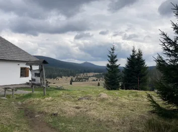
From the center of the village, follow marked bike trail No. 2154 around Okrouhlík Hill (708 m above sea level) to the rock formation known as Marie Terezie, and then continue downhill to the dam of the Hořejší Padrťský Pond. The Padrť Ponds, named after the now-defunct village of Padrť, are one of the most important tourist destinations in the central Brdy Mountains. They were established in the 16th century by Florián Gryspek of Gryspach, the owner of the Mirošov and Rožmitál estates, as a water source for floating timber to the local ironworks. Today, they are part of the Brdy Protected Landscape Area. In nice weather, you can enjoy views of the surrounding scenery, reminiscent of the Šumava plains. From the dam, follow the red hiking trail up a gentle slope to the ruins of the former Benedictine monastery in Teslín, which stood here in the Middle Ages and was destroyed by the Hussites in the first half of the 15th century. Today, only the foundations of the buildings and two small ponds remain visible. From here, continue to the intersection below Břízkovec (718.8 m above sea level), on whose summit a U.S. missile defense radar was to have been built. Turn right following the red trail markers, and at the intersection, go straight ahead. Pass by Trokavecká Rock, where you’ll join bike trail No. 2154, and head back to the parking lot.
- Route: Trokavec – Okrouhlík – Hořejší Padrťský Pond Dam – Teslín Monastery – Břízkovec – Trokavecká Rock – Trokavec
- Difficulty: an easy route with small, gentle elevation changes
- Starting point: Trokavec – parking in the village center or by the forest above Trokavec
- Route length: 10.5 km
- Elevation gain: 103 m
- Refreshments: Trokavec – Na Pančavě Pub